Sitting in Founders house again, bringing this log to date. 45 Minute drive from Murray River.
SEPTEMBER 21, Thursday, sunny
After packing, we left for Murray River so that we are closer to the ferry in Wood Islands. We arrived at our site in River Camping and paid for 3 nights @ $11/night. Passport again. We are waiting for our mail and will do the East Cape while here and hopefully some kayaking. Fuel in Murray River @.98 cents X 86 L. Looked at a couple of quaint little shop in the village than called it a day. It's cloudy now and cooled off.
N46* 01' W62* 36' Alt:47' and a distance of 105 km for today
SEPTEMBER 22, Friday, Sunny in a.m. and cloudy and rain in latter part of day. Strong winds
Left at 11a.m. for the Cape and drove along the Bay on Hwy 17 Some of the little villages we saw were Montague, Georgetown, Souris (where the ferry to Islands of Madeleine is situated) and stopped for lunch at the "Singing Sands Provincial Park" It was still very windy so didn't stay long. The sand on the beach is formed by the sandstone and silica which creates a sensation of hearing the sands singing.
Arrived at the East Cape N 46*27' W 61*58' Took a few pictures (see link) and walked around the cape. This is where the tides of the Gulf of St Lawrence and the Straight of Northumberland meet which creates some formidable waves, we are told. There was a spit which was being covered but you could see it anyway. A lot of shipwrecks here too.
We went up to the top of the light house and looked around. The light house was built in 1867 and was moved twice due to the erosion of the Cape.
Drove back along Hwy 16 for a while on the north side of the island then cut across to Hwy 4 and home. Arrived back at 5:30 p.m. where we found two new neighbors.
SEPTEMBER 23 Saturday, Cloudy and cool
Looks like we will have to spend an extra day here as our mail has not arrived yet. I phoned home and it was mailed over a week ago.
It rained last night And again this morning. Windy again.
Took a drive to Murray harbor and the light house where the distress signal from the Titanic was first heard and relayed to New-York.
There is a 70 miles long yard sale happening locally. This is an annual event and reminded us of home and our yearly yard sale in Logan Lake.
Spent most of the day reading.
SEPTEMBER 24, Sunday. Cloudy, forecast for rain again
Not much happening. We are in Charlottetown for something to do and decided to bring this log to date and download our most recent pictures.
Sunday, September 24, 2006
Wednesday, September 20, 2006
Sept 16 to 20, 2006
I am now sitting in the Founders' house writing this blog. It is Sept 20th. I feel quite proud of being a Canadian after seeing this place, the birth of Canada. Our history is more interesting than we give it credit. I feel honored to be sitting here, in this historic town, and write my blog.
Let's go to the beginning shall we:
Sept 16, Saturday, sunny and warm
We left Shediac by 10:30 a.m. and drove Hwy 15 to 960 then headed for the coast. We arrived at the Confederation Bridge around noon. What a site!!!!! AWSOME!!!! Took a few pictures and then drove across the 13 km. long bridge and we arrived in P.E.I. We stopped at the info centre which had lots of things to see. IT was a village in itself. Got info on PEI, looked around at all the neat things then headed for our campsite in Borden-Carlton. $12.50 a night (Passport).
After setting up, we drove to Summerside, 25 km away, looked around and bought a few groceries. Came home and relax.
SEPT 17, Sunday, Sunny
Up at 7 a.m. Had a lousy sleep as we are near the hwy and it was very noisy over night. Decided to move on to another Passport campsite north of here. Packed and drove up Hwy 1 E to Charlottetown and stopped at a info centre, then we followed Hwy 2 W, then North on Hwy 7 to Oyster Bed Bridge.
A really nice campsite by the Rustico Bay. Nice view to boot. Price is right @ $14/night we paid for 4 nights. Set up on site A35.
We met the brother of another guy and his wife whom we had met in Moncton and again at Borden-Carleton. What a small world this is.
Left our site at 3 p.m. and headed on Hwy 6 along the coast for some sightseeing. In Cavendish, we saw Anne of Green Gable but didn't stop then headed for Avonlea and got to go in for free as it was almost closing time. Returned home via hwy 251. This is such a small Province. Actually smaller than Vancouver Island. One can drive from one end to the other in less than 300 Km. Everything is only a couple hours away.
We have a racing track next door and there is a big race going on. Very noisy but after dinner, all was quiet and we had a marvellous sleep.
I like PEI very much...It is quaint, small, tranquille, and easy, lay-back living.
SEPT 18, Monday, Cloudy and windy with a few sunny break
After making a light picnic, we headed out to the North Cape. Followed hwy 251 then 224, 254S adn then North on hwy 2. Country side is absolutely delighful. It's like a fairy land with its undulating hills and farming field of potatoes and veggetables. There are a few dairy farm too.
As we got further north, the clouds became more omnimous and it was raining by the time we got there.
We stopped at Jacque Cartier National Park where he apparently stopped for a while, then on to Tignish and visited the fishing village and walked the beach. It is misty and very windy.
North Cape was a short 10 minutes away. We looked around the info centre and than drove the back roads along the cape. From here, one can see the three side of the cape, the St-Laurent Gulf surrounds it with the Straight of Northumberland on the east side. They had to move the light house something like 8 times due to the erosion of the cape. It is all sandstone, very red and very fragile. There is also a 2 km spit which was being cover by the high tide when we got there.
After eating lunch, we headed south along the East coast on hwy 145 then cut across to hwy 2 in Campbellton. We stopped in Summerside for a few groceries then headed home. Arrived back at 5 p.m. Set up the dish and watched the tube.
SEPT 19, Tuesday, Sunny
Very windy again today but warm. Today we went to Charlottetown and visited the sights there. Drove down hwy 6 where we saw a scarecrow that was really neat and well done. Took a picture of it, then drove on to town. Charlottetown has a population of only 35 000 people.
Small yet the biggest town on the Island.
We visited Founder's house where we saw the most intereting display of the events that took place around the birth of Canada confederacy. It was very impressive and made us feel proud to be Canadians. Our history is more interesting than we give it credit for.
From here we walked the town....Water St, Queen St and a few others. It reminded us a lot of Victoria but it does have more older building of the 1800 era. Somewhat like Quebec. We visited the Provence House where the discussions of formong Canada took place and saw where the present government sits.
From there, we walked more of the town then went for a well deserve beer and snack at the "Merchantman Pub", an old building where the food was good and the service excellent.
Got back home around 5 p.m. and relaxed and reminisced over our day.
SEPT 20, Wednesday, rain, clouds and windy
It rained all night but it is very warm this morning. Also very, very humid.
We are in town a the Founders Hall where they have WIFI and we are going shopping so see you all later.
ENJOY ALL THE PICTURES!!!
Saturday, September 16, 2006
Sept 9 to 15, 2006
SEPTEMBER 9, Saturday, cloudy/rain
Decided to stay another day. Will work on my blog. Downloaded more pictures which took almost 2 hours. It's 2:15 and raining A good day to read
SEPTEMBER 10, Sunday, sunny
A gorgious day. There are white caps on theocean. Left at 9 a.m. and headed southwest. Stopped at the National Parc of Ristigouche and looked over the exhibit there. Very interesting historical facts on the sinking of the french fleet ( 3 of them) by the english.
After an hour there, we headed back to Pointe de la Croix and crossed over the Petitcodiac river into New-Brunswick. Stopped at the info centre and looked over the town of Campbellton. Very nice people and helpful.
Drove along the coast north-east then south to Miramichi formely known as Chatham. THe drive was not that interesting as the road doesn't really follow the coast but is more inland.
At Miramichi, we crossed the bi-centennial bridge, headed 10 km south and found our Passport campsite, "All Night All Day" in Black River Bridge. Cost was $25 (week-ends including Sunday) for tonight then 12.50 during the week.
Oh yeah, we moved our clock one hour ahead to Atlantic time. We are now 4 hours ahead of BC.
N46*58' W65*19' Altitude: 112, Distance: 367 km (includes Gaspe drive)
SEPTEMBER 11, Monday, sunny
A cold night, went down to 4-5* C Left with the trauck only at 10 a.m. and went ot eexplore Miramichi. Visited the downtown and took a few pictures. Spoke with a woman who was very informative about the area and drove north along the shore to an Island called "Middle Island" IT was used in the early days as a quarantine centre for the people coming in from Europe. A lot of Irish died here due to fever and other disease and were buried in mass grave. Now there is a memorial dedicated to their saga. There was also a local doctor byt eh name of Vondy who died of the same fever from treating the sick there. He was the only one that volunteered to look after them. He paid the ultimate price.
From here, we followed the shore line (hwy 117) which turned out to be somewhat boring too. At St-Louis De Kent, we turned onto Hwy 11 and continued south to Bouctouche. That was really interesting. We saw the Irving Eco Centre and walkway (2 km long)) over this dune. Irving is the principal oil company here in New-Brunswick. The village itself was very quaint and lots of old building from the early days.
Drove back to our site and by 20:30 we had dinner and were sitting relaxing. A very interesting day overall
SEPTEMBER 12 Tuesday, Sunny
Another cold night. Down to 2-4*C Up at 8 a.m., packed and left by 10:30 went south on Hwy 11 to Shediac, the Lobster Capital of N.B. and only 20 km from Moncton.
We arrived at 12:30 at our site, Etoile Filante, another Passport member at $68 for 4 nights. We set up camp at site 66, with full hook-up, cable and WIFI.
Very windy today, our thermo shows only 18*C and it's 3:50. Went into town to buy some necessity such as milk, beer and wine. Bought a couple of lobster at $8.99/lbs cooked. This is a very nice town and very tourisque. definitely a destination place.
Met two couples from BC. One from Slamon Arm and the other from Surrey. Had happy hour together.
N46*13' W64*3' Altitude: 17' Dist: 110 km
SEPTEMBER 13, Wednesday, sunny
Said good bye to our new friends whom were headed out this morning, washed the truck and Kenzie.
At one p.m., we headed out and went to see "Magnetic Hill" in Moncton. Kind of a interesting site with lots to do such as a zoo and little train, a real tourist place. The hill itself was disapointing. A short one. Magnetic hill is an optical illusion. You are actually going down a small incline then up another small incline. When you look at it, it appears to be all one going up but in fact, it is an illusion.
From there, we went into town and walked the old downtown. Lots of interesting buildings. We also watched the "bore" come in on the river bed. The tide was out and the river banks were all mud. IT made for an itneresting view. The "Bore" is a tidal wave coming up the river. It precedes the high tide coming in. It can be anywhere from 1 to 4 feet high. The one we saw, was about 2-3 feet. (see pictures)
Drove on to Hopewell Rock, south of Moncton and saw the "flower pots" at high tide. Then it was onwards to Bay of Fundy National Park then home. Alma at the entrance of the park was a really quaint fishing village , very picturesque.
Arrived back a tour site at 7 p.m. and had steak and lobster (fresh). The park is almost full again
SEPTEMBER 14, Thursday, cloudy wiht sunny breaks
Up at 8:30. After a good shower and breakfast, we headed for Hopewell Rocks again but this time at low tide.
We walked the whole beach and saw each rock form the bottom. A different perspective from yesterday. All I can say is WOW! WOW! WOW! It was absolutely beautiful and awsome. Check out the pictures. They don't do justice but will give you an idea.
Came home and realxed for the rest of the day. Tomorrow, we move on to P.E.I. I called and made reservation in two differnt site for two time frame. Also called to have our mail forwarded to the second camp south of Charlottetown. We are looking forward to that.
Weatehr has been great so far and the forecast is for more for the next week
Saturday, September 09, 2006
August 31 to September 8, 2006
AUGUST 31, Thursday, Sunny but a lot cooler
Took Tucker out for a haircut then went for a drink a the local terrasse while waiting. Came home and loaded the top bars on the truck, washed it, packed the kayaks and golf gear.
SEPTEMBER 1, Friday, Sun and cool
Helped Gilles all day today then sat by the fire in the evening. A quiet day
SEPTEMBER 2, Saturday, Sunny with clouds
Johnny, Ginnette, Andre and Peter showed up in the afternoon and the party began. Had lots of laughs and recalled lots of memories. Had a good dinner which felt like a typical old family meal. We had chilli by Val and roast pork by Lise with all the trimmings.
Sat by the fire afterwards and didn't go to bed until 1 a.m. Johnny and Ginnette slept over in our rig.
SEPTEMBER 3, Sunday, Clouds and drizzles
Had a good breakfast then helped Gilles with the house some more. Peter left in the afternoon. We had pizza for dinner....nothing beats a good Quebec pizza!
Sat by the fire and it was party time again. Went to bed at midnight and Johnny and Ginnette stayed over again.
SEPTEMBER 4, Monday, Cloudy, drizzles
Therese, Michel and Christiane showed up late in the morning and we had another small party by the fire. It drizzled on and off all day but we still managed to have fun. Everyone left by 9 p.m. as Gilles had to leave for work. Said our goodbyes to him then went to bed by 10:30
SEPTEMBER 5, Tuesday, Cloudy and some sun
What a wonderful week-end we had, it was a great send-off! Went for last minute groceries, put away the rest of the stuff, dumped and cleaned the sewer line For dinner, we went to St-Hubert BBQ restaurant with Gaetan and Diane, then went to their place for a coffee and left at 10 p.m.
Chatted with Lise for a while then went to bed. This is our last night here and I feel really sad about leaving. We had a good time and it was great spending so much time with my family. Thought a lot about my parents and wished they had been here.....I miss them!
Took lots of pictures and everything is downloaded
To date, we have put in 81 hours 6 minutes of driving time on the road for a total of 6403 KM. All this time and mileage excludes anything done here in Quebec.
SEPTEMBER 6, Wednesday, sunny with some clouds
Got up at 7 a.m. , had a coffee then went to say bye to Lise and Anthony. He was really worried that he was going to miss saying good-bye!
After packing the last minute stuff, I checked the wheels as my brothers had pointed out that they were awfully close. Sure enough there is a problem. Drove to Lucien and they replaced the springs without charge as they had collapsed. Not sure how or when. Anyway, we never hit the road until 3 p.m.
Past Quebec city, we entered into unfamiliar territory. The drive was really beautiful with lots to see. The St-Lawrence valley is gorgeous.
We stopped at Wal-Mart in Riviere-du-Loup. There are a dozen rigs here already. I am ready for bed
N 48*49' W 69*33' Altit: 190' distance 356 km
SEPTEMBER 7, Thursday, sunny

Up at 6;45 and on the road by 9 a.m. after having a Mcmuffin . The night was cool at 12*C Fall is here.
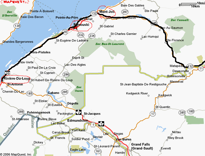
We followed hwy 132 now, all the way. Stopped in Rimouski for a look around. Then it's off to Mt Joli where we turned away from the river and headed inland to the far side of the Gaspe peninsula.
We stopped in Causapscal for lunch and purchased a couple of souvenirs. Left an hour later and arrived on the coast of Bay de Chaleur and Carleton at 3 p.m.
We are on a spit with an absolutely gorgeous view of the sea and New-Brunswick on the other side.
We are a very fortunate couple. The moon came out later in the evening adding a very romantic side to things. We met a couple from Saskatchewan on their way home from Gaspe. Went for a walk on the beach and headed for a much needed rest in bed.
N48*05' W 66* 07' Alt: 26' Distance: 367 KM.
SEPTEMBER 8, Friday, Sunny
Af ter a good night, we hit the road again at 9.a.m. with the truck only. Packed a lunch and drove to New Richmond for our first sightseeing tour, the Gaspesian British settlement but the blooming place was shut down for the season. Drove on to Bonaventure where we visited the Acadian site and learned about their history. A very interesting but sad history with a major epic of survival, courages and perserverance.
People are extremely friendly and eager to help us find our wayher in Gaspe region. There were no problems with english either.
From here we drove on up the coast. The scenery was absolutely incredible....very hard to describe but it was worth the trip. Rolling hills and quaint little houses. I love the Quebec look. The mountains are beginning to show the colors on the trees.
We reached the crest of a hill to be met by the most incredible view....Perce Rock!
A life long dream has come true finally.
Perce is at Lat N48* 31' Long W64* 13'. I always thought it was the furthest point driveable but found out later that Point St-Pierre is further: longitute W64*11'
Perce has a population of 3600 friendly people. The National site was filled with colorful buildings and the view was absolutely incredibly spectacular. This is where I finally found my Quebec flag mounted on a wood pole. Been looking for one since I got here. Also bought a couple of souvenirs.
We spent an hour here then drove on to Gaspe.
Stopped for lunch in Barachoix by a neat little bay with a view of the rock. Arrived in Gaspe to another breathtaking view/site. Very quaint little town of 15000 people situated at N48*49' W64*29' We went to see the museum and the place commorating Jacques Cartier and his Cross
The ride here was something else. Grade on the road as steep as 15% (glad I didnt take "Kenzie" through this)
We headed back to Perce where we dinner and paid a fortune then drove into the sunset and home. Arrived at 9 p.m., tired but the day was worth it.
Took Tucker out for a haircut then went for a drink a the local terrasse while waiting. Came home and loaded the top bars on the truck, washed it, packed the kayaks and golf gear.
SEPTEMBER 1, Friday, Sun and cool
Helped Gilles all day today then sat by the fire in the evening. A quiet day
SEPTEMBER 2, Saturday, Sunny with clouds
Johnny, Ginnette, Andre and Peter showed up in the afternoon and the party began. Had lots of laughs and recalled lots of memories. Had a good dinner which felt like a typical old family meal. We had chilli by Val and roast pork by Lise with all the trimmings.
Sat by the fire afterwards and didn't go to bed until 1 a.m. Johnny and Ginnette slept over in our rig.
SEPTEMBER 3, Sunday, Clouds and drizzles
Had a good breakfast then helped Gilles with the house some more. Peter left in the afternoon. We had pizza for dinner....nothing beats a good Quebec pizza!
Sat by the fire and it was party time again. Went to bed at midnight and Johnny and Ginnette stayed over again.
SEPTEMBER 4, Monday, Cloudy, drizzles
Therese, Michel and Christiane showed up late in the morning and we had another small party by the fire. It drizzled on and off all day but we still managed to have fun. Everyone left by 9 p.m. as Gilles had to leave for work. Said our goodbyes to him then went to bed by 10:30
SEPTEMBER 5, Tuesday, Cloudy and some sun
What a wonderful week-end we had, it was a great send-off! Went for last minute groceries, put away the rest of the stuff, dumped and cleaned the sewer line For dinner, we went to St-Hubert BBQ restaurant with Gaetan and Diane, then went to their place for a coffee and left at 10 p.m.
Chatted with Lise for a while then went to bed. This is our last night here and I feel really sad about leaving. We had a good time and it was great spending so much time with my family. Thought a lot about my parents and wished they had been here.....I miss them!
Took lots of pictures and everything is downloaded
To date, we have put in 81 hours 6 minutes of driving time on the road for a total of 6403 KM. All this time and mileage excludes anything done here in Quebec.
SEPTEMBER 6, Wednesday, sunny with some clouds
Got up at 7 a.m. , had a coffee then went to say bye to Lise and Anthony. He was really worried that he was going to miss saying good-bye!
After packing the last minute stuff, I checked the wheels as my brothers had pointed out that they were awfully close. Sure enough there is a problem. Drove to Lucien and they replaced the springs without charge as they had collapsed. Not sure how or when. Anyway, we never hit the road until 3 p.m.
Past Quebec city, we entered into unfamiliar territory. The drive was really beautiful with lots to see. The St-Lawrence valley is gorgeous.
We stopped at Wal-Mart in Riviere-du-Loup. There are a dozen rigs here already. I am ready for bed
N 48*49' W 69*33' Altit: 190' distance 356 km
SEPTEMBER 7, Thursday, sunny
Up at 6;45 and on the road by 9 a.m. after having a Mcmuffin . The night was cool at 12*C Fall is here.
We followed hwy 132 now, all the way. Stopped in Rimouski for a look around. Then it's off to Mt Joli where we turned away from the river and headed inland to the far side of the Gaspe peninsula.
We stopped in Causapscal for lunch and purchased a couple of souvenirs. Left an hour later and arrived on the coast of Bay de Chaleur and Carleton at 3 p.m.
We are on a spit with an absolutely gorgeous view of the sea and New-Brunswick on the other side.
We are a very fortunate couple. The moon came out later in the evening adding a very romantic side to things. We met a couple from Saskatchewan on their way home from Gaspe. Went for a walk on the beach and headed for a much needed rest in bed.
N48*05' W 66* 07' Alt: 26' Distance: 367 KM.
SEPTEMBER 8, Friday, Sunny
Af ter a good night, we hit the road again at 9.a.m. with the truck only. Packed a lunch and drove to New Richmond for our first sightseeing tour, the Gaspesian British settlement but the blooming place was shut down for the season. Drove on to Bonaventure where we visited the Acadian site and learned about their history. A very interesting but sad history with a major epic of survival, courages and perserverance.
People are extremely friendly and eager to help us find our wayher in Gaspe region. There were no problems with english either.
From here we drove on up the coast. The scenery was absolutely incredible....very hard to describe but it was worth the trip. Rolling hills and quaint little houses. I love the Quebec look. The mountains are beginning to show the colors on the trees.
We reached the crest of a hill to be met by the most incredible view....Perce Rock!
A life long dream has come true finally.
Perce is at Lat N48* 31' Long W64* 13'. I always thought it was the furthest point driveable but found out later that Point St-Pierre is further: longitute W64*11'
Perce has a population of 3600 friendly people. The National site was filled with colorful buildings and the view was absolutely incredibly spectacular. This is where I finally found my Quebec flag mounted on a wood pole. Been looking for one since I got here. Also bought a couple of souvenirs.
We spent an hour here then drove on to Gaspe.
Stopped for lunch in Barachoix by a neat little bay with a view of the rock. Arrived in Gaspe to another breathtaking view/site. Very quaint little town of 15000 people situated at N48*49' W64*29' We went to see the museum and the place commorating Jacques Cartier and his Cross
The ride here was something else. Grade on the road as steep as 15% (glad I didnt take "Kenzie" through this)
We headed back to Perce where we dinner and paid a fortune then drove into the sunset and home. Arrived at 9 p.m., tired but the day was worth it.
Subscribe to:
Posts (Atom)